
Mapping
● Raster symbols were added to many programs, including borehole location maps, point maps, statistical diagrams, and RockPlot3D.
● Contour map color schemes and color legend options, including a greatly improved color pallet creator, are available.
● Dynamic filled scalebars are available for RockPlot2D maps.
● Create a total depth grid and contour map through the Borehole Manager based on the base elevation of boreholes.
● Spatial filtering for Borehole Manager maps plotting downhole stratigraphic, water level, and I/T-Data labels have been added.
Logs, Sections, and Profiles
● Vertical scalebars can now plot labels showing depth below a datum and with different settings for the left and right axes.
● Well construction strip logs are drawn based on the order defined in the well construction type table, making it easier to display overlapping well components.
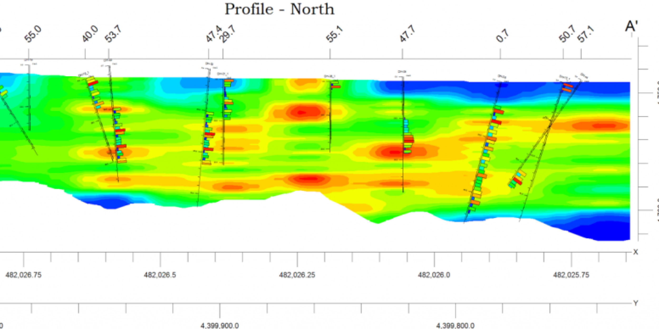
● Contoured sections and profiles are drawn much faster.
● Water levels in 2D and 3D strip logs can be colored based on the aquifer types table.
● Well construction strip logs are drawn based on the order defined in the well construction type table, making it easier to display overlapping well components.
● Contoured sections and profiles are drawn much faster.
● Water levels in 2D and 3D strip logs can be colored based on the aquifer types table.
Borehole Manager Database
● Backup project tools are available.
● The adjusted borehole elevations based on a grid feature now provide options for updating the collar elevation field.
● The Excel, text, and CSV data Import options for water levels and I/P/T Data more easily append data from new sampling events to the database.
● Import point Shapefiles into the Borehole Manager database to create new boreholes
Stratigraphy/Lithology
● Use contact data defined in a RwDat file during stratigraphy model creation, such as surface contact information (dip angle and direction), geophysical data, seismic data, etc.
● The Stratigraphy Picker has the option to snap to existing lithology contacts.
● Lithology isopach creation, now offering both grid-based and voxel-based tools
● The Stratigraphy Picker has the option to snap to existing lithology contacts.
● Lithology isopach creation, now offering both grid-based and voxel-based tools
I/P/T Data
● I-Data length composite weighting program, including options to limit the calculations to data between two gridded surfaces and to specify a background grade for missing intervals.
●Time graph tools, including the additional spatial and time filters.
●Time graph tools, including the additional spatial and time filters.
